body · Observational composite
The Moon: 100 m per pixel imagery, from an overview to a 35 km floor
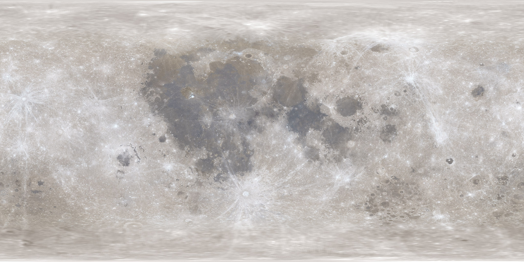
The Moon is COSMOS’s deepest surface path. A packaged NASA SVS/LROC colour pyramid supplies the overview, and NASA/JPL Moon Trek serves the global LROC WAC morphology mosaic up to about 100 m per pixel without upscaling.
Measured facts
- Classification
- Natural satellite
- Mean radius
- 1,737 kmPublished mean radius stored as renderer geometry.
- Mean diameter
- 3,475 km
- Mean radius in Earth radii
- 0.273
- Appearance
- Tiled observational surface
- Observation epoch
- Historical multi-observation mosaic; not live
What you are looking at
Every requested tile also requests its complete ancestor chain, and the nearest ready ancestor stays visible until the child is at least 94% opaque. A missing service tile therefore reveals real lower-resolution imagery instead of a blank shell.
At deeper levels a same-dataset Moon Trek backdrop remains beneath the child tiles, so the viewport edge cannot expose a colour or source discontinuity.
Tycho is searchable and flyable as an IAU-named feature with its Gazetteer coordinates and 85.29 km diameter. Its name and position are catalogue data; the visible surface remains LROC imagery.
Distance, scale and light time
Distances here are computed from the shipped JPL Horizons state archive, sampled once per day across its declared coverage (2020-01-01 00:00 TDB through 2040-01-01 00:00 TDB). Because both bodies move on different orbits, the separation changes constantly; the figures below include the dates at which the extremes occur.
- Distance from Earth
- 0.003 AU · 387,439 kmAt the recorded snapshot epoch 2026-08-29 00:00 TDB, one-way light time 1.3 seconds.
- Closest Earth approach in the archive
- 0.002383 AU on 2034-11-26One-way light time then: 0.02 minutes.
- Farthest separation in the archive
- 0.002719 AU on 2025-11-20One-way light time then: 0.02 minutes.
- Mean separation across the archive
- 0.002574 AUSampled once per day across 2020-01-01 00:00 TDB through 2040-01-01 00:00 TDB (7,306 samples).
Delivery and camera limits
COSMOS stops the camera at 1,772 km from the body centre (35 km above the mean-radius surface) for Moon. Surface providers are protected because every imagery product has a native ground sampling distance, and magnifying past it would imply resolution the dataset does not contain.
- Appearance status
- Tiled observational surface
- Renderer provider id
- moon-visual-v1
- Declared resolution
- 303 pixels/degree, approximately 100 m/pixel at the lunar equator
- Closest permitted approach
- 1,772 km from the body centre (35 km above the mean-radius surface)35 km minimum safe altitude keeps delivered imagery pixels near the rendered pixel footprint. The renderer clamps the camera's centre distance, so the two figures differ by one mean radius.
- Rotation model
- Approximate static display orientation — Not yet a selected-date body-fixed solutionNo external orientation kernel is used for this body.
- Geometry
- mean-radius-sphereMean-radius sphere; no ellipsoid or terrain displacement yet
Provenance
Appearance provenance is carried by the provider at runtime, not added by the page: an active appearance layer is registered.
- Category
- observational-composite
- Provider
- NASA Solar System Treks / JPL Moon Trek
- Project / mission
- Lunar Reconnaissance Orbiter — LROC WAC
- Dataset
- LRO_WAC_Mosaic_Global_303ppd_v02
- Version
- Moon Trek WMTS release exposed 2026-08-29
- Licence
- NASA/PDS public-domain data; cite NASA/GSFC/Arizona State University and LROC Team
- Attribution
- NASA/GSFC/Arizona State University; tiles served by NASA/JPL Moon Trek
- Source checked
- 2026-08-29
Limitations COSMOS discloses
- No terrain displacement
- Static mosaic does not change with ephemeris date
- Detail stops at the delivered imagery ceiling
- No terrain displacement: this is a morphology mosaic on a mean-radius sphere, not a shape or elevation model.
- Lunar libration and a precision lunar orientation model are not integrated yet; the Moon’s orientation remains an explicitly approximate, near-static solution.
- The floor is 35 km, where the delivered mosaic is close to its native ground sampling.
- Position is interpolated inside 2020-01-01 00:00 TDB through 2040-01-01 00:00 TDB; requesting an epoch outside that window is rejected instead of extrapolated.
Questions this page answers
- How far away is the Moon?
- Inside the recorded 2020–2040 archive the Earth–Moon distance ranges from perigee to apogee, and the figures on this page are computed from that archive rather than quoted from a table. Because the Moon’s orbit is elliptical, "the" distance is always a range plus a date.
- Can COSMOS show the far side of the Moon?
- Yes. The LROC WAC mosaic is global, so travelling around the Moon shows real imagery on the far side. Because the Moon is tidally locked, you reach the far side by moving the camera, not by waiting for the Moon to rotate it into view.
Datasets behind this page
- JPL Horizons planetary state archive (2020–2040)NASA/JPL Horizons · derived-scientific-model · One discrete geometric state vector per object at JD 2461281.5 TDB
- NASA Moon Trek LROC WAC morphology mosaicNASA Solar System Treks / JPL Moon Trek · observational-composite · 303 pixels/degree, approximately 100 m/pixel at the lunar equator
Content updated 2026-09-26. Every value on this page is computed from the shipped datasets; where a source publishes no value, the page says so instead of estimating one.