body · Observational composite
Explore Earth in 3D with NASA Blue Marble imagery
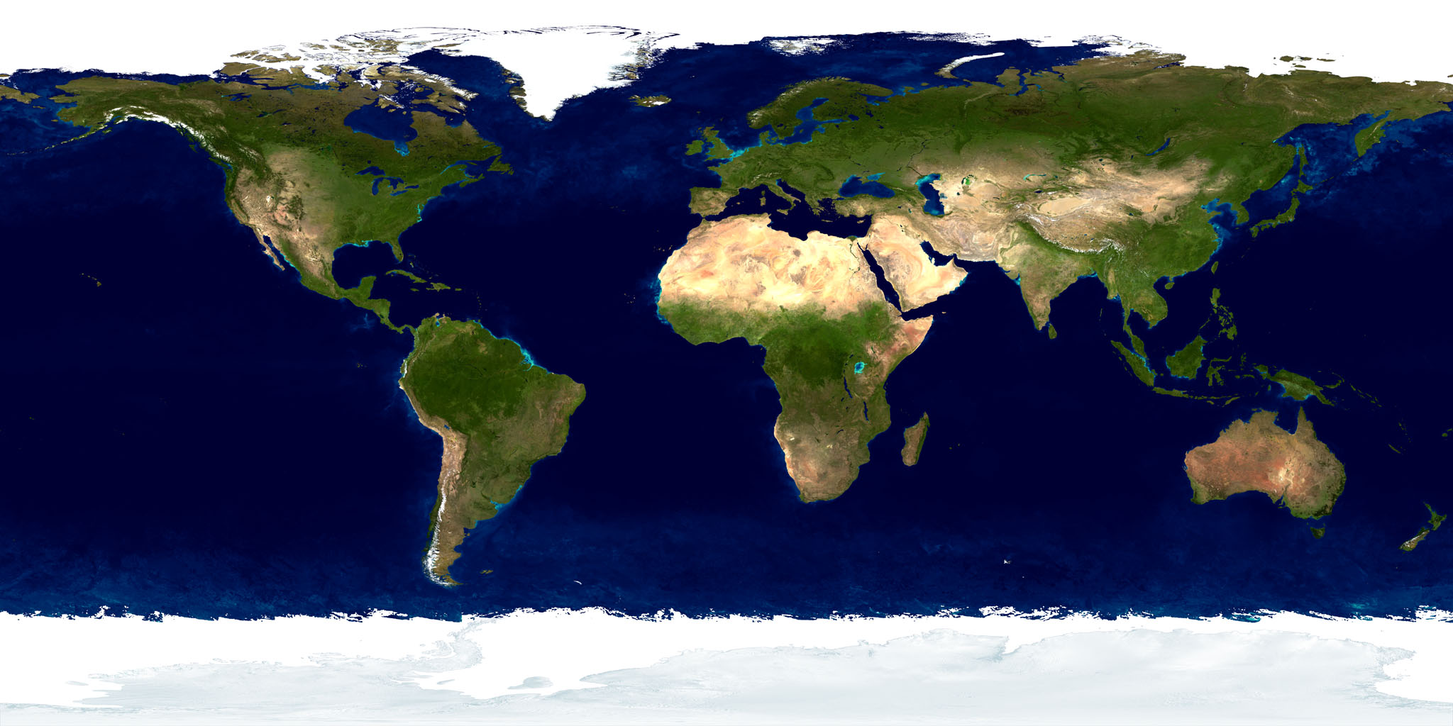
Rotate Earth, zoom towards continents and oceans, then travel out to the Moon and planets in the same interactive universe. The surface uses a historical, cloud-free NASA Blue Marble composite at measured scale. It is an observational mosaic, not live weather or a current satellite photograph.
Measured facts
- Classification
- Terrestrial planet
- Mean radius
- 6,371 kmPublished mean radius stored as renderer geometry.
- Mean diameter
- 12,742 km
- Mean radius in Earth radii
- 1.00
- Appearance
- Tiled observational surface
- Observation epoch
- Historical multi-observation mosaic; not live
What you are looking at
The surface is the Blue Marble Next Generation shaded-relief and bathymetry layer served as native 256-pixel tiles through NASA EOSDIS GIBS, refined to zoom 8. COSMOS reprojects those Web Mercator tiles onto spherical patches.
It is a composite, not a photograph. Land colour, ocean colour and sea ice come from different observations, combined into a cloud-free global mosaic, and the source shading in the relief layer is not geometry.
Earth keeps its verified GMST and mean-obliquity orientation model with UT1 approximated by UTC. Mercury, Mars, Jupiter, Saturn, Uranus and Neptune instead use NAIF pck00011 body-fixed models, and the Galilean moons share Jupiter’s.
Distance, scale and light time
Distances here are computed from the shipped JPL Horizons state archive, sampled once per day across its declared coverage (2020-01-01 00:00 TDB through 2040-01-01 00:00 TDB). Earth is the origin of the Earth-centred frame, so its distance from Earth is zero by definition.
The heliocentric figure is the meaningful one for Earth: the mean distance from the Sun changes through the year because Earth’s orbit is slightly elliptical.
- Distance from the Sun
- 1.010 AU · 151,090,743 kmComputed in the same epochs and frame (Earth-centred ecliptic J2000.0 / ICRF).
Delivery and camera limits
COSMOS stops the camera at 6,551 km from the body centre (180 km above the mean-radius surface) for Earth. Surface providers are protected because every imagery product has a native ground sampling distance, and magnifying past it would imply resolution the dataset does not contain.
- Appearance status
- Tiled observational surface
- Renderer provider id
- earth-visual-v1
- Declared resolution
- 500 m source visualization; delivered to zoom 8 (~611 m/px at equator)
- Closest permitted approach
- 6,551 km from the body centre (180 km above the mean-radius surface)180 km minimum safe altitude keeps delivered imagery pixels near the rendered pixel footprint. The renderer clamps the camera's centre distance, so the two figures differ by one mean radius.
- Rotation model
- Earth-fixed → ecliptic J2000 — GMST / mean obliquity; UT1 ≈ UTCNo external orientation kernel is used for this body.
- Geometry
- mean-radius-sphereMean-radius sphere; no ellipsoid or terrain displacement yet
Provenance
Appearance provenance is carried by the provider at runtime, not added by the page: an active appearance layer is registered.
- Category
- observational-composite
- Provider
- NASA Global Imagery Browse Services (GIBS)
- Project / mission
- NASA EOSDIS / Blue Marble Next Generation
- Dataset
- BlueMarble_ShadedRelief_Bathymetry
- Version
- GIBS best-available static layer, checked 2026-08-29
- Licence
- NASA imagery usage guidelines; no commercial-provider dependency
- Attribution
- Imagery courtesy NASA EOSDIS GIBS
- Source checked
- 2026-08-29
Limitations COSMOS discloses
- No terrain displacement
- Static mosaic does not change with ephemeris date
- Detail stops at the delivered imagery ceiling
- No terrain displacement: the relief shading is baked into the source imagery, not a height model.
- The mosaic does not change with the selected ephemeris date; it is a static composite.
- Detail stops at roughly 611 m per pixel at the equator, and the camera will not descend below 180 km.
- Position is interpolated inside 2020-01-01 00:00 TDB through 2040-01-01 00:00 TDB; requesting an epoch outside that window is rejected instead of extrapolated.
Questions this page answers
- Does the Earth in COSMOS show current cloud cover?
- No. The Blue Marble layer is deliberately cloud-free and historical. COSMOS has no live weather or dated cloud layer, and it does not claim one.
Datasets behind this page
- JPL Horizons planetary state archive (2020–2040)NASA/JPL Horizons · derived-scientific-model · One discrete geometric state vector per object at JD 2461281.5 TDB
- NASA Blue Marble surface imageryNASA Global Imagery Browse Services (GIBS) · observational-composite · 500 m source visualization; delivered to zoom 8 (~611 m/px at equator)
Content updated 2026-10-25. Every value on this page is computed from the shipped datasets; where a source publishes no value, the page says so instead of estimating one.